S/V INTREPID II - Cape Dory Intrepid 40

My photo
Intrepid II is a Cape Dory Intrepid 40 sailboat, hull #2, designed by Chuck Paine and discovered by the Captain in Blue Hill Maine in 2006. The crew are Kelly (Captain) and Carol (Admiral and Blogger). In 2009 INTREPID II embarked on her West Coast journey from Victoria to San Francisco, the Baja Sur Peninsula and into the Sea of Cortez. In 2010/2011, we sailed from Guaymas, south to Bahia Banderas and back. In 2011/2012 we left Guaymas, headed south to La Paz, spent three weeks at anchor on our northward journey and rested on the hard in San Carlos. Her 4th, 5th and 6th seasons were Boat Projects related. Season 7 - an incredible amount of boat work - but no cruising. Season 8 - Tropical Storm Sergio toppled Intrepid II in San Carlos dry storage. A disappointing season of serious and costly repairs. Season 9 - continuing those repairs and still hopeful for cruising. 2024 - well cruising plans certainly have been dashed the past few seasons!
Showing posts with label Baja California Sur anchorage. Show all posts

July 16, 2012

Anchorages in review - Bahia Santa Inez (Punta Chivato) (April 23 - 24)

Slowly working through the logbook and wx (weather) notes and enjoying revisiting our recent cruising experiences.....)
Dolphins swimming by
Sunday's Sonrisa weather forecast for Monday's planned departure was 'brisk:  NNE 15 - 19, with Tuesday promising NNE 13 - 17 knots.  Both days' wind offerings were to be 'right on the nose' for a crossing over to San Carlos and Guaymas. Stan's forecasts suggested Monday would be W 10 - 15 and Tues NW 10 - 15; better for a crossing, but 'on the nose' for continuing up the peninsula towards Santa Rosalia.  Flip a coin!  Later that hot, muggy afternoon, several boats left to anchor near the mouth of the bay at Santo Domingo for a brief rest before making their crossing.  We waited for the expected ENE 11 -14 late afternoon winds.  By 16:45 however, INTREPID II shifted position and winds filled in to N 14 -15, cooling us off somewhat.  We made our preparations to leave for 'somewhere' in the morning.

Monday morning the engine was on at 07:00 and we were away at 07:12 in the quiet, still morning.  As we turned north to head up Bahia Concepcion we were greeted by dolphins who kept us company, then bid 'adios' as we tuned up the SSB for the early bird net.  No success checking in, but we managed to do so by asking for a weather fill from Geary. That provided a chance to thank him for his hospitality when we stopped by a few days earlier.  He was predicting winds NE 9 - 11 for the morning, increasing to NNE 15 - 20 for the afternoon. This made a south facing anchorage a good option for the moment - 23 nm further.

Weather guru Geary and Kelly - visiting at El Burro Cove
Once we were passed Santa Domingo and the protection of land to the east, we felt the full effect of NE swells. The NNE winds had started blowing much earlier out in the centre of the Sea.  Kelly took over hand steering as our auto-pilot was not at its best in the roll and chop of these swells, trying to maintain a 333 degree heading.  We had the main up, jib on starboard tack and were making 7 knots. At 10:00 hours our GPS noted we had reached 27 degrees 00.10N.  We were now in the "North Sea" which is an arbitrary distinction for weather purposes.  Apparently there is a marker on shore noting this geographical spot.
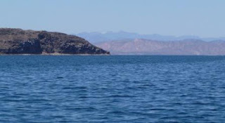
Heading towards Bahia Santa Inez mid-morning
With all the 'to-ing and fro-ing, pitching and yawing' INTREPID II was experiencing, we decided to head in to the anchorage ahead to see conditions for ourselves.  Otherwise it would be a very long slog to Santa Rosalia.  This spot is known for a great shelling beach along the west side and we'd wanted to explore it.  Shortly after, we were hailed on the VHF by a voice who inquired if we'd heard the weather forecast and were familiar with this anchorage.  His information was that the wind might shift around to the SE in the evening and we would be on a lee shore.  Once we motored in behind the low headland on which a hotel is located and watched the swell and winds, we decided to stay and tucked in at 13 feet over a sandy bottom.  Engine off at 11:03 and mark the spot:  27 03.967 N 111 57.666 W.  SPOT message sent - time for lunch!
Anchored with hatches wide open - still very hot days
Hotel on south-east point
Boat launch and nearby home
That afternoon SV Content followed our track and chose to join us in the anchorage; stopping by later for a chat from the dinghy as they took Max and Emma ashore.  The helpful radio contact fellow also rowed out;  he is a local resident who enjoyed boating and tried to alert cruisers to the local conditions.  Ed had kind and admiring words for INTREPID II and joined us in the cockpit for a glass of wine as we traded stories and enjoyed the view.  
Friendly resident rowing over to visit
Disappointed, we postponed our trip to the shelling beach as we anticipated having to leave very early the next day.  Our evening was quiet, the wind stayed in the N - NE quadrant and we rolled to only a slight swell.  One ear open for shifts.   A pleasant place in the right conditions.

July 11, 2012

Anchorages in review - to Bahia Concepcion (April 18)

Just before dawn
The forecast for Wednesday (on Tuesday) was for either ESE 15 - 20 knots (Geary's wx) or SE 10, with seas SE 1 - 2 feet and W 10 - 15 at night (Stan's wx).  We awoke at 05:30 to a 1013 bar, light SW winds 8 - 10 and a light south west swell.  Our options included Bahia Santispac in Bahia Concepcion - 55 nm, Santa Domingo - 47 nm and Punta Chivato - 56 nm.  So a planned journey of 9 or 10 hours, possibly shorter, if the SE winds cooperated with INTREPID II.   SV Dune had left much earlier; they had planned to be underway by 4:30 am.  The pre-dawn hours are special times. We had a crescent moon overhead as we raised the anchor and the main quietly, waved adios to San Juanico and headed out at 06:25.  Sunrise followed at 06:58; beautiful and peaceful as we motored northbound, passing La Ramada anchorage in 2 foot swells.  
Sunrise

Not much success with accessing weather updates on the Sonrisa net.  We were able to check in with Ellen  of SV Galatea who was net control that day.   Interestingly, she and Jim were underway, nearing San Carlos on the mainland and we could pull them in; but as we were heading closer to Bahia Concepcion and Geary's home base of El Burro Cove north west of us across a low mountain range, we had interference. About the same time, the Captain made the discovery that our batteries were not charging!  The latest challenge!

SV Content radioed us on VHF to advise they had left San Juanico as well and were about 30 minutes behind us;  they had no success hearing the weather update either.  We motored passed Punta Pulpito which was less forboding in the early light and passed the sand dunes on the north side of Punta Santa Teresa.  Mid morning brought longer swells and calmer seas, as we continued on a 327 degree heading at 6.7 knots; later an adjustment to 312 degrees around Punta Santa Teresa.  At 11:25 SV Dune called to advise they were near Bahia Concepcion, but were going to continue on to Santa Rosalia - keeners! 

Punta Pulpito off port side
Sand dunes north side of  Punta Santa Teresa


Fishing ....
The day was pleasant and sunny, the winds had not yet filled in.  It is always a mystery as to when "afternoon winds" will show up.  The current and swells were not in our favour, but you can't have everything.  Fishermen waved from their panga; a dozing seal lay on its back, flippers in the air.
Dozing seal ....
Punta Concepcion 
Now that we were closer to our destination we didn't want strong SE winds, as we prepared to turn west and then south into Bahia Concepcion and have them be on the nose.  What greeted us was a large fishing vessel at the head of the bay.
Trawler and gulls
However, with a SE 10 wind we were able to boost our speed to 7 knots with a 179 degree heading, so no complaints.  It is about an hour long trip down into the smaller anchorages of Bahia Concepcion; the depths are very shallow and this time there were tiny black flags bobbing here and there very close to the channel.  

Courtesy of Avalon Travel and Moon.com

Turning right at Punta Piedrita, we found an empty anchorage, except for one small sailboat at a mooring; the restaurant owner's vessel.  As we motored and watched for seaweed and sandy spots, the wind started to rise from the north - local conditions?  At 14:55 we were anchored in 25 feet at 26 45.819 N, 111 53.112 W after a long 9 hours, but not strenuous ones.  Later, checking our distance and fuel consumption, we we disappointed to discover we used 8.5 gallons motoring 8.5 hours. We turned our thoughts to tidying up and watching for the arrival of SV Content and then make a visit to the beach.  (Of course - it was Wednesday and "Ana's" was closed.)

INTREPID II anchored in Bahia Santispac

Anchorages in review - San Juanico and weather challenges

Thank goodness for the 'flopper stopper'
Our stay at San Juanico was overall a great one.  Although tempered by the strong winds and the ongoing need to plan ahead for a good weather window to leave for anchorages further north, we like it here.  Definitely the cruisers' conundrum:  when should we leave?

We were receiving weather reports such as:  "fresh north winds will commence in the Gulf from 26 N - 29 N by Sunday night as an inverted surface trough develops along the eastern coastal sections of the gulf with high pressure shifting closer to the Baja Peninsular from W - NW...".  

Then we'd get reports of winds to be in the W 19 -25 knots and seas WNW 4 - 7 feet at 5 seconds for that Saturday followed by NW 16 - 21 knots with seas NW 2 - 4 feet at 3 seconds for the Sunday under consideration.  The third day out (Monday) promised the strongest weather, with WNW 17 - 23  knot winds and seas 3 - 6 feet at 4 seconds.  As we've mentioned, although the winds and direction are certainly a consideration in planning our next passage, it is the 'bufaloes' or short, square waves at very short intervals, which make for lumpy, rolly, uncomfortable hours.  These waves are very effective at stopping forward motion when you finally get the sails set to head in the right direction.
[BTW:  a knot is 0.539956803456 of a km/hour]

The cruisers' nets provide us with first hand information about what folks were currently experiencing in their anchorages and passages.  A few boats in San Juanico anchorage started out on Sunday, very early, hoping to make headway long before the winds and seas built.  They had turned back and were re-anchored by the time we were having breakfast.  There was no respite that day, as the seas had not laid down overnight.  By 11:00 we had 17 - 20 knots (31 - 37 kms/hour) and white caps out in the channel, with 2 foot wind waves slapping at the hull.  Forecast was accurate!


Water bird ballet
The local wildlife were out and about in spite of the brisk conditions.  We viewed the rafts of small sea birds who floated nearby, expertly choreographed to turn and dive as one and pop up beside another vessel.  Our best guess is that they were 'Eared grebes'.  A neighbour radioed over that she had spotted a pinkish toned sea lion nearby.

On Monday, Geary's weather report advised of a 7 mb gradient in the Sea, which meant more strong winds, with a Tuesday forecast of N 13 - 17 and Wednesday of ESE 15 - 19 knots.  The weather  reports from "Stan" were for Tuesday NW 10 - 15 and Wednesday SE 5 - 10 and seas flat.  A bit of a variance; although, as we all appreciate, these forecasts are for a large, general area, not taking into account local conditions.  So, that gives you a sense of what we puzzle over when considering our next moves.  By now, we were looking at the remaining days we had available; not exactly a 'schedule', but still some pressure to move on and possibly by-pass some 'would be nice' spots.  The forecasts for the day of NNW 9 -11 for the Southern Crossing (south of us) and N 12 -15 (north of us near Santa Rosalia) promised reasonable breezes and the morning was calm and settled.


The Captain figured conditions wouldn't be better and jumped in the cold! water (68 F) to check the propeller and zincs; all was well.  We dinghied to the beach to stretch our legs and chat with other folks who were walking their dogs.  Homeward bound the waves were building and we noticed our snubber had jumped off the anchor chain; it was a wet time fixing it.  Time to let out more chain.  Our weather log for the day says "HA!!  At 12:35 we were getting gusts up to 23 knots (42 kms/hour).  By 16:30 some calmness returned to the waters and folks were out and about again.  So the 2nd bocce tournament was a go on the beach.  Another chance to relax and compare notes for departures.  By now we were all decided we had to keep moving and would take what the weather gods sent.

Pelicanos...just bobbing along

June 22, 2012

Anchorages in review - San Juanico (April 13 - 18)

Anchored facing easterly swells
Saturday April 14th: Happy 6th Birthday Gracie! 
Jester, Jabber and Admiral ashore
Here we are!  On our arrival here in February we didn't put the dinghy in the water and headed south much too soon.  This morning it's time to explore!  We have a 'baby Bruce' anchor for our dinghy and ensured it was well secured before we headed off to stretch our legs. Time to get reacquainted with all that is special about San Juanico.  Kelly headed out on the dry, dusty road around to La Ramada.  Carol explored for shells and set a slower pace.  By noon a light chop has arisen, giving us a bouncy exit out of the dinghy back onboard.  Shades of things to come.
Captain returning from hike

Trail starts here....
Behind the beach...trails and a dusty road inland
Low tide with the Spires on left (osprey nests) and the Hump on right

SV Content crew on beach
Later we puttered around in the dinghy; said hello to Phyllis, Gary and Sophie aboard SV Appolima out of Vancouver and chatted about the 'old days' in Bluewater Cruising.  We met Paula, Bill and boat dogs Max and Emma coming back from a run on the beach  We've have many sociable visits with this crew as our travels continued.

That evening, tuned in to the Southbound Net, we heard the sad news that Don Anderson, SV Summer Passage, had passed away onboard his boat and was found by friends this morning.  Don was a well regarded "weather guru" of the Amigo and Southbound nets; his forecasts and advice were the basis for many cruisers' decisions or at the very least, given serious consideration.  It was a somber moment; each of us had specific moments to recall in our contacts with this generous man who had spent so much of his time giving back to the cruising community.

[Don's obituary in part:  Scientist and long-time sailor, Donald Anderson, passed away on April 13, 2012, aboard his boat, Summer Passage. Don was well known in both the scientific and yachting communities to which he provided many years of leadership and service. His sudden passing was a shock to his family and friends.  More than anything else, Don loved to sail. He built and raced small boats in the 1950s and 60s, and in 1970, acquired his first offshore sailboat, the 32-foot Scotch Mist. In 1973, Don accepted a transfer with Chevron to Southern California where he joined Balboa Yacht Club and continued his racing success. Don, with family and friends, would race and cruise Scotch Mist extensively for the next 20 years. In particular, Don and Scotch Mist were heavy weather animals-the meaner the race, the better they did. Don's name may be found engraved on several major ocean racing perpetual trophies... In 1991, Don married his second wife, Joan. A year later they purchased the Valiant 47, Summer Passage and began outfitting her for globe-circling voyages to fulfill one of Don's lifelong dreams.  In 1998, Don and Joan sailed to Hawaii from Newport Beach, beginning what would become a 30,000 mile cruise through the South Pacific and South America. It was during his time in the South Pacific that Don began sharing his weather observations with fellow cruisers as Summer Passage was equipped with receivers for real-time and forecast marine weather.  Don would say that growing up in the British Isles, "Weather was always the first topic of polite conversation, even between complete strangers." Upon returning to California, Don honed his weather forecasting and routing skills, and in 2002, he and Joan moved to Oxnard, where Don constructed a world-class radio station providing the capability to transmit his weather information to hundreds of yachtsmen throughout the Pacific. Many of these "strangers," some of whom he would never meet in person, became Don's close friends. He kept a regular and rigorous schedule on the "nets" where Don's voice is now sorely missed.]
Summarizing our time at San Juanico:

Walks on the beach, introducing new folks to the "cruisers' shrine" and seeing if our INTREPID II burgee was still holding up from 2009 and 2010. It needs to be repainted for sure.  World class Bocce Tournaments, enjoying the antics of four legged friends, playing Mexican Train dominos aboard Mood Indigo, wondering where on earth the National Geographic ship would anchor and whether we`d all get invited for cocktails (not!).  Kelly and Bill going fishing and not noticing the wind picking up in their sheltered cove; Paula and I each rehearsing "Plan B" if our anchors dragged and the fellows were still focused on the fish!  Watching, as always the ospreys on their nest and soaring around spotting their next meal. Moon rise over the Spires, countless stars overhead.  Hunkering down when the wind blew strong, wet dinghy rides ashore when it died down; planning for the next leg.  Having to head north all too soon.
Cruisers`shrine 
Max looking for his tennis ball
Emma and Mo - should we go in...
Successful Fishermen heading back
National Geographic arrives
A peaceful evening
A very special place 


Anchorages in review - San Juanico - Arrival (April 13)

Nav station with weather notes, log book and 'to do' list
Friday, April 13th: we often hear that cruisers should not head out on this date.  We rationalize that our cruise is 'in progress'.  We left La Paz ten days ago and our log book records this fact for any wind or sea gods to please take note!

It is 69 F in the cabin, 62 F outside, 67 in the pool and the bar is 1014. Stan's forecast is for W 4 - 6 kms and WSW 12 - 16 kms at night for the northern half of the Sea; NW 14 - 19, with WNW 6 - 8 for the southern half. Saturday could be W 15 - 21. These are weather updates we receive via Winlink from a volunteer weather guru who's full time job is as a vet.  Guru Geary advises for the northern crossing (Santa Rosalia to Guaymas) Friday am NE 6 - 9 with afternoon winds ENE 13 - 17; for Saturday NE 18 - 23 kms.  The Loreto area should see SSE 10 - 13 kms for the afternoon.

Checking out cruising guide enroute

Basically we know the winds will be stronger in the next few days.  We want to be someplace secure where we can spend a few days with some options for moving around as the winds sort themselves out.  36 nautical miles away lies Caleta San Juanico, tucked in behind Punta San Basillio.  This anchorage is a special place and one we always look forward to.  Today we were underway by 08:15, expecting to take 7 hours for the trip.


Heading north we quickly were hit by 2 - 3 foot swells from the north-east. These would continue for the entire trip, building to 4 and 5 feet at times; definitely impacting our progress.  This was a motor sail trip.  The winds finally picked up to 12 knots SE at 14:30, so we got a boost at long last. Along the way we heard SV Salish Sea on the VHF and found that Ian and Diane were heading into Guaymas already for their haulout.  The reception was so clear we thought they were on the Baja peninsula side!

As we headed into Caleta San Juanico, the winds shifted to the east and we wondered what that would bring in the way of swells. The small bay in front of the cruisers' shrine was occupied by one sailboat in such a considerate way no one else could fit in.  Everyone else had lined up further west from north to south. INTREPID II 'parked' between Mood Indigo to port and Content to starboard.

San Juanico neighbours
INTREPID II at anchor San Juanico
On with the anchor snubber, out with the flopper stoppers; with one out off the boom to starboard, anticipating those easterly swells.  By 15:00 we were settled in at 26 degrees 22.001 N, 111 degrees 25.831 W, looking forward to a few days of rest, hiking and catching up with friends.  There were so many things to record that we'll have to have a separate blog posting!


Anchorages in review - Punta Perico South, Isla Carmen (April 11 - 13)

Looking to west shore of Punta Perico
This morning we listened to comments from cruisers around the central Sea of Cortez as they checked in to the Sonrisa net.   Southerly winds clocking round to westerlies occurred everywhere. No one had a good night, it seems.  Diane on SV True Love, anchored at the Coronados, advised things had been 'idyllic until the wind went nuts!"  At Bonanza beach on the SE side of Isla Espiritu Santos, the corumels blew 18 to 20 knots all night; a power boat dragged in Aqua Verde.  Seems we were in good company.  We didn't envy our volunteer weather gurus when the 'localized' conditions turned their necessarily generalized forecasts upside down and they listened to all our tales of woe.

Geary predicted "northerlies in most of the sea for Wednesday and Thursday", so it was time to move on.  We wrote 'who knows?" in our boat log under Forecast.  Our sights were set almost due north of us, to Punta Perico South, on the east side of Isla Carmen, 17 nm away.  This small bay offered good north wind protection and was just under 4 hours away.  At 10:00, in overcast skies promising to clear to blue, and a WSW wind of 12 -15 knots, we checked our depth as we motor sailed past the islets; just 30 feet at one spot.  At noon our sails were filled, engine was off and we enjoyed the quiet, sunny day, making just over 5 knots.  We could see our destination.  Our sail was graced with visits by a jumping ray, dolphins leaping and swimming along side, flights of pelicans and a curious sea lion.


Of course, the wind plays games and we were heading too far to NE.  A quick tack to port, but our speed was dropping to 3.7 knots.  On with the engine and rolled up the jib to make our way in to yet another "new to us" anchorage.  At 13:40 we were anchored in 17 feet at 25 degrees 58.289 N, 111 degrees 04.583 W. The winds filled in from the north at 14 - 15 knots, as predicted.  A quick lunch and then a long nap!  We felt secure and sheltered and needed to catch up on last night's lost hours.

Fishermen's camp on shore
Although the winds continued in the 15 knot range, we enjoyed our chance to relax and observe the small fish camp onshore.  The beach here is a gravel one; the fishermen appear to store supplies in the small cave on the western side of the bay.   A starry, starry night appeared; so different from 24 hours ago.  We were fascinated by the phosphorescence lighting up the water.  Something was swimming swiftly to and fro and putting on a show.  A quiet night.
Soft skies at dusk looking towards Bahia Salinas
Thursday morning we heard on the net that a strong earthquake had been felt on the mainland, near Los Cardenas, north of San Carlos.  Winds were still expected to be NNE 15 - 19 near Loreto, just around the corner.  A good day to stay put and do boat chores.  We also checked in to the Amigo Net (8122) and made contact with SV Picara who were sailing offshore.  It was satisfying to have a quick chat with Mike and wish him and Marnie continuing good winds as they headed towards the Marquesas.  We later determined that the earthquake had been magnitude 6.9, centred closer to the Baja peninsula, but felt strongly in the San Carlos area.  Not all that far away, but we hadn't noticed any impact on the water.

It was a busy day for radio contacts as we heard from folks on SV Charlotte Alane and SV Tamburan.  Today's 'norther' seemed to be staying in the 16 knot range and very manageable.  Towards 17:00 pm we were joined by a power boat who anchored, then re-anchored and put out a stern line.  They quickly dropped their dinghy with a splash and zipped off to fish for the evening's main course. 
North shore - gravel beach
East side of Punta Perico - with reef extending south
Cacti marching up north slope
Later that evening, we listened to the Southbound net for an update on the earthquake but didn't learn anything more.  We turned in with the north wind gusting to 12 kms.  It shifted to the west about 03:00; we ended up rolling in the swell which hit us on the beam.  Dragged ourselves up at 06:30 finally as there was not much sleep to be had. 
Layers and colours and contours

Anchorages in review - Yellowstone Beach, Isla Monserrat (April 10 -11)

White sand and yellow limestone bluffs
Our morning weather update from Geary on the Sonrisa ham net was for winds ESE 15 - 19 knots for the 'northern crossing' some distance away, and SSE 11 - 14 in the Puerto Escondido/Loreto area, which was approximately 30 nm northwards.  We needed to find an anchorage offering SE protection and considered Aqua Verde, Candeleros and the north end of Isla Monserrat.   By 09:30 we were underway, leaving the rusty red rocks of Los Gatos anchorage with blue skies overhead, seas rippled and 70 degrees already.   Kelly had to raise only 40 feet of chain by hand this time, as the windlass still was catching.  Definitely need to fix that problem!

Winds were light, SW 7 - 10;  we motor sailed our way with the jib partially rolled out.  The VHF radio caught our attention as SV Tamburan hailed us as they passed Timbabichie.  They thought Candeleros or all the way into Puerto Escondido would be their target for the night.  A large splash off our beam signaled a breaching whale.  Shortly after that surprise, Kelly spotted wing tips about 10 feet off starboard.  |Then -  just under the surface, a 6 foot manta ray, head flaps very apparent, glided passed INTREPID II.  That was a treat!  At noon we were in the vicinity of Aqua Verde and spotted 2 boats leaving with at least 6 masts in the north anchorage and 1 in the southern. By then we had determined we would try for Yellowstone Beach and add a new anchorage to our experience.  Off we went on a heading of 350 degrees to the north end of Isla Monserrat.
Courtesy of GatoLoco Sailing
The seas were becoming somewhat confused as we rolled out the jib further and revved back on the engine.  Without much warning, we were being knocked  about by steep 2 - 3 foot westerly swells and pondered whether this could be refracted swell this far from shore.  The Tamburam crew called to say they were experiencing the same situation closer to shore near Candeleros.  As we inched our way to the north end of the island and cleared the low headland we spotted a large motor vessel anchored off the white sand beach.  Drawing well around the shallow underwater reef which extends out from the northwest shore we could see the rocky islets known as "Las Galeras", which are known to offer great diving.
Layers of yellow limestone weathered by wind
The shoreline offered white sand beaches topped by distinctive yellow limestone bluffs, offset by sparkling clear green water.  We anchored at 14:45 inshore of MV Safari Quest, in 15 feet, with a scope of 110 feet. (25 degrees 42.533 N, 111 degrees 03.080 W) The cruising guides promised us wind and wave protection from south and southwesterly winds, although we should expect swell wrapping around the point.   Nothing we hadn't experienced at every other anchorage!  The westerly swells were manageable with the flopper stoppers at work on each side.

A big wind event building
As we zipped on our sun shades and were admiring the views we noticed an increase in the wind speed and choppiness of the waves. The dinghy stayed onboard; the winds continued to build but all was secure.  The motor vessel brought in the last of its explorers, raised anchor and headed south.  We had Yellowstone Beach to ourselves.  As the weather deteriorated we were very glad of that fact.  No vessels to drag into us and if we dragged, we'd end up in Topolopampo on the mainland, as the Captain commented the next morning.

This was a stressful and exhausting evening and night.  The ESE winds clocked and clocked again until we were facing west winds.  Mo anchorages were protected in the vicinity from that direction. Checking in with the evening Southbound net at 18:55, we advised winds were gusting to 18 knots and seas were in the 3 foot range in our anchorage.  Others advised they were experiencing W 20 - 30 knots in Bahia de Angeles and 15 - 20 at the Coronados.  More scope let out.  Our highest gust was 23 knots overnight. There was little sleep for us as we checked our position against the GPS mark. Black outside, no lights on the island and the clouds obscured the stars.  One for the 'worst night' scenario books!
Waves building